 |
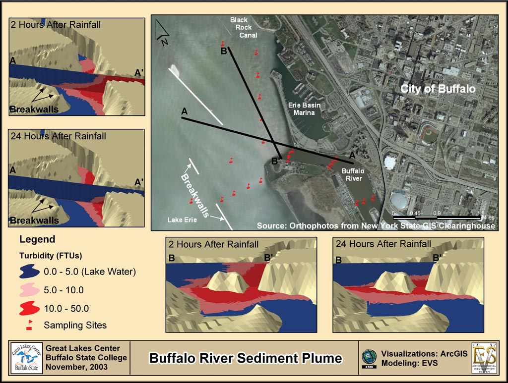
| Buffalo River Sediment Plume |
Loads to a water body can result from point sources such as industrial discharges or nonpoint sources such as agricultural runoff. Once the loads to a water body are known, water quality models can be used to determine concentration changes within the water body. Procedures that utilize a GIS have been developed for both types of load calculations and for water quality models.
Mitigating Threat
GIS helps identify and map critical areas of land use and reveal trends that affect water quality. For example, ArcGIS Geostatistical Analyst can be used to map river contamination.
Use GIS to monitor water levels, water usage, and watch for trends to avoid overdraft and drawdown. ArcGIS 3D Analyst can map multiple contamination layers at multiple depths. (source: ESRI)